


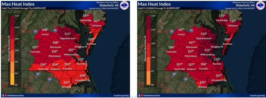
The National Weather Service’s Wakefield office issued an extreme heat warning for our area, lasting from 10 Thursday morning until 8 Friday night. Hot weather will continue through the July 4 festivities.
This is the first Extreme Heat Warning issued for the Williamsburg area this summer and could be the most significant heat wave in years, because of a dome of high pressure sitting over the area, the weather service said. Such warnings represent the National Weather Service’s highest level of heat alert because of the danger of heat-related illnesses.
The warning means the weather service expects heat index values of up to 112 degrees for Williamsburg, James City and York counties, as well as Charles City, New Kent, Gloucester, Mathews and Prince George counties.
The heat index is a measure of heat stress in direct sunlight, used as a planning tool by the military, that factors in temperature, humidity, windspeed, sun angle and cloud cover.
Forecasters expect the rest of the week to be hot:
Thursday: Sunny and hot, high near 100°F with heat index values up to 109°F.
Friday: Sunny and even hotter, high near 102°F with heat index values up to 112°F.
Saturday (Independence Day): High around 101°F before an increasing chance of thunderstorms arrives Saturday night and continues into early next week.